Note: Pages about areas of Slough such as this one are based on historic or accepted common usage rather than the artificial boundaries of the wards as set up by the Local Government Boundary Commission.
Cippenham
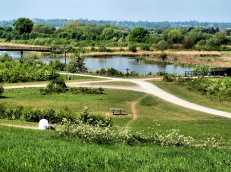
For simplicity this page combines the two wards in the south-east of Slough, Cippenham Green and Cippenham Meadows. The residential area of Cippenham is almost totally confined by the Bath Road, the M4 motorway, the Huntercombe Spur and the A355 Tuns Lane. A large area of countryside spills over to the south of the motorway and includes a sizeable section of the Jubilee River.
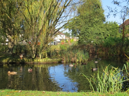
The village pond
The name Cippenham comes from Old English and means Cippa’s homestead. In the late 19th century, Cippenham Green consisted of a pond, a green, farmland and a population of a little over 400.
Major residential expansion along the Bath Road began after the First World War as Slough Trading Estate began to develop. Further expansion occurred after the Second World War and since the 1980s, and even further development came with the building of the Windsor Meadows, Cippenham Meadows and Cedar Green housing estates. According to the 2011 census, the population of Cippenham Green was 9,447 and Cippenham Meadows was 12,116, giving a total of 21,563.
In 1988, ASDA superstore was built and reportedly served between 8,000 and 10,000 customers on its first day. The retail park on Twinches Lane was built the following year.
Cippenham Moat
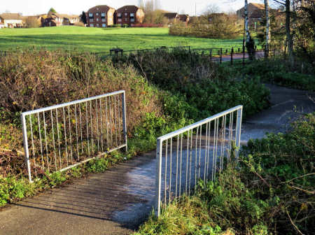
In the 13th century, Henry III had a palace built at Cippenham. His brother Richard, 1st Earl of Cornwall, had a deer park created there. The palace is long gone but is thought to have been sited at Cippenham Moat which was discovered by early Victorian farmers. Several artefacts, particularly roof tiles of about the era, have been found there and it is now a listed monument. Cippenham Moat lies just north of ASDA store (must have been convenient) and part of the area is shown in the photograph beyond the bridge.
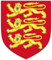
To read more about Richard 1st Earl of Cornwall click on the shield below:
Dad’s Bridge
My late father, who lived near Cippenham Moat and used a disability scooter, contacted the local council to have this bridge installed. The path had ended at the ditch which was hazrdous to negotiate. To Slough Borough Council’s credit it was built within a couple of weeks.
The bridge meant that my dad could use the bridge in complete safety on his trips to the Jubilee River. It has also become well used by other people these days, particularly by ASDA customers from the housing development Cedar Park. Well done SBC.
Cippenham Court Farm
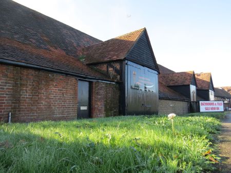
First recorded in 1481, Cippenham Court Farm ranged from Farnham Royal to Dorney, and from Huntercombe Lane to the Three Tuns. It was owned by Eton College and the much diminished farm was still working until the mid-1960s. The original house didn’t survive but Cippenham Court was built on the site. Three barns did survive in varying forms of disrepair however, and have been restored to be used as commercial properties.
The Long Barn
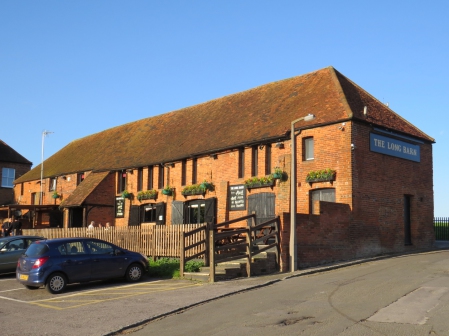
The Long Barn public house on Cippenham Lane is one of the three former barns still standing that once belonged to the original Cippenham Court Farm. This building dates from the 17th century and has some 18th century additions. The building was granted Grade II status in 1975.
The Long Barn has a large south-facing patio
Prior to becoming a pub, the Long Barn was actually a long barn for 300-400 years. In May 2013 Tommy Flynn’s took possession and completely removed the Long Barn signs in favour of signs bearing the name of the chain. In late 2014, I am pleased to report that Tommy Flynns has reapplied the name the Long Barn once more.
The Great Barn
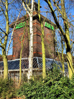
The Old Barn
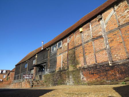
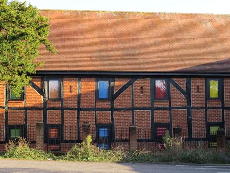
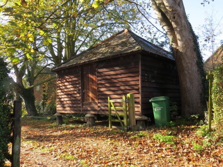
This is the third of the Cippenham Court barns. Built in the late 17th century, the building had fallen into a very poor state. It originally consisted of five timber-framed bays, one of which had collapsed beyond repair. A corrugated asbestos roof was fitted sometime in the early to mid-20th century.
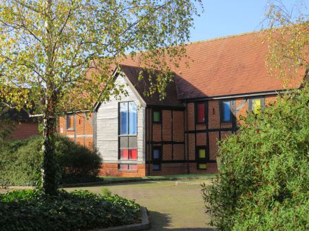
Later it became quite derelict until 1987 when the structure was rebuilt with much of the original timber frame design in place. It was first occupied by Comdisco UK and named Comdisco House. The name was dropped after Comdisco left and is now known as the Old Barn.
The Old Barn
It is a fresh–looking building needing at least a second glance to realise its true age. The freshness is helped along by the colourful window blinds installed by the current occupants, the UK marketing division of STABILO. Best known for their highlighter pens, hence the colourful blinds. STABILO have been tenants here since 2008.
STABILO
Schwan STABILO is a private German company founded in 1997 but with a history that can be traced back to the pencil manufacturing company Grossberger & Kurz Bleistiftfabrik formed in 1855. STABILO introduced fluorescent markers in 1971 and is the world’s largest manufacturer of highlighter pens.
The Old Barn, west side
Products manufactured by the STABILO group include: coloured pencils, ballpoint pens, marker pens and highlighter pens. The field of cosmetic products such as eye liner, mascara and lipstick comes under the Schwan Cosmetics brand. Outdoor equipment such as backpacks are made by Deuter Sport and ORTOVOX Sportartikel, the latter also being a brand of outdoor clothing.
The author expresses his grateful thanks to STABILO for their friendly cooperation with this article and photographic permissions. The website British Listed Buildings was also particularly useful for confirming historic details.
Cippenham Place
Cippenham Place was rebuilt in the 16th century and is a Grade II listed building. Like Cippenham Moat, pottery has been found on the property and evidence of earthworks along with an Anglo-Saxon moat. It has been suggested that this might have been the true site of the palace/hunting lodge.
Cippenham Lodge
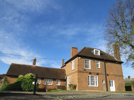
Built in 1709 for John Perryman then Sheriff of Buckinghamshire, Cippenham Lodge was once home to a farmer named Mr Twinch after whom Twinches Lane is named. Cippenham Lodge is sited on Cippenham Lane and is a Grade II listed building. It is currently occupied by The Look Inn, a market research venue provider.
Slough Sewage Treatment Works
Situated on the south side of the M4 motorway, Slough Sewage Treatment Works notoriously used to produce a particularly bad smell. It was blamed on the unique mix of industrial sewage from Slough Trading Estate as well as domestic sewage. At the time the sewage works was fairly isolated from residential housing and the smell usually dissipated over surrounding farm land.
During the 1980s, various chemical perfumes were tried to make to make the smell less distasteful but were not really satisfactory. The problem was resolved at some point in the 1990s partly due to Thames Waters efforts to neutralise the smell but it’s also thought to be due to changes in the type of industry on the trading estate.
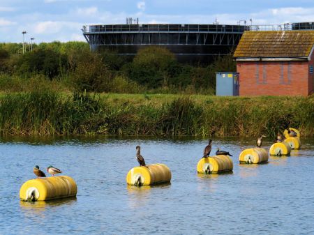
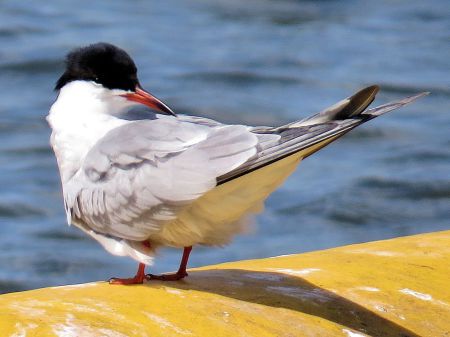
Cormorants enjoying a clean environment
Environmental issues about the plant are even more positive these days. The waste left over from the treatment process is used to produce about 3·5 billion litres of biogas which is used to provide the site with 65% of its own energy needs. Even more recently, Thames Water invested in a nutrient recovery reactor which is the first of its kind in Europe. It extracts ammonia and phosphorus from waste which is then used to produce fertiliser.
The new reactor should produce some 150 tonnes of phosphate fertiliser reducing the need to import mined phosphate from countries such as the USA and China. The removal of the chemicals also and cleans the effluence from the sewage works which in turn improve the environment.
Cippenham Lane housing
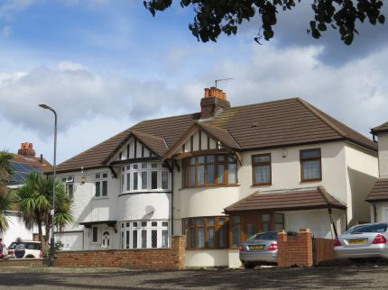
Postcards from Slough is studying some houses of various styles and eras. Examples of each style will appear in the pages of the other Slough areas in this website as we feel apporoprite.
Here is an example of semi-detached housing on Cippenham Lane. These were built in the 1930s and are the most numerous houses along the north side of the Cippenham Lane. There are other houses from different eras in the area, this style is well represented in Cippenham.
A friend of mine told me that he believed these houses were sold for about £700 when new. A few doors away, a similar property was sold in 2017 for £415,000. It was described by the estate agent as a 2 bedroom semi-detached character family home. It has a garage and driveway and a larger than average rear garden.
Cippenham Cinema
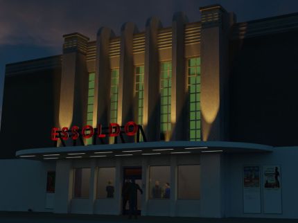
The Essoldo Cinema opened as the Commodore on 30 November 1938. It had been built at a cost of £50,000. It was situated on the Bath Road on the east side of the Stowe Road junction. At 90 by 180 feet with a height of 40 feet it must have been a magnificent sight in Cippenham Green at the time.
The Commodore included a ballroom at ground level. Upstairs was a café and the 1,500-seat auditorium which in, addition to the cine projection, hosted live entertainment. It boasted a 45 feet wide proscenium and a 17-foot deep stage equipped with a Lafleur (Hammond) electronic organ. Backstage, four entertainers’ dressing rooms had been provided.
The Commodore stayed open throughout the war. In October 1949, the cinema was purchased by the Essoldo circuit and became known as the Essoldo.
The Essoldo Cinema in Cippenham circa 1957
Eventually, as the success of television increasingly impacted on cinema going, the Essoldo ceased to operate as a cinema. In common with the fate of many cinemas, the Essoldo became used as a Bingo hall in the late sixties or early seventies.
It was used for dance lessons and there was a hairdressing salon but for some time in the early seventies the Essoldo was closed until near the end of the decade when the ballroom was converted into a snooker hall.
The auditorium was converted into a night-club named Libertys. The club did well and especially on Friday and Saturday nights which were often filled to capacity. Patrons enjoyed opening extensions to 2 am at a time when late licenses weren’t common.
After a few years, Libertys began to flag in popularity and the name was changed to Shoes. The whole building finally closed down and was demolished in 1986. A Jaguar car showroom was built in its place.
This is a brief and abridged account on the Essoldo Cinema. For a much fuller story of this building visit cippenham.org by clicking on the Clapperboard symbol.
Chalvey Airfield
Although known as Chalvey Airfield its location was within the present-day Cippenham area.
Benton and Allen
Born in 1883 in New South Wales, Australia, John Frederick Benton was an Electrical Engineer living in Pinkney's Green on the edge of Maidenhead Common. He designed experimental kites which he used to raise aerials to improve radio performance and other kites for commercial advertisements. A steam-powered winch was used to raise a man-lifting kite on which he made flights of up to three hours.
Benton was determined to build his own powered aircraft so he persuaded William Allen, a local camera maker, to give up his business and put his skills to use in aviation. From 19 June 1911, they rented a 35 acre field from Walter Spackman of Manor Farm, and erected a hangar in which to construct their aeroplanes, many of the parts of which they manufactured in a small engineering works in Sewage Meadow, Green Lane, Maidenhead.
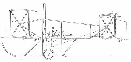
Benton’s first design was the B.I Air-Car, a large double biplane powered by a 35hp water-cooled NEC engine. It incorporated various innovations which Benton had patented. It only achieved a few short hops but it led to an improved version, the B.II Air-Car. The B.II was entered as No 31 in the Daily Mail Circuit of Britain Race on 22 July 1911 but the design was no more successful so the entry was withdrawn.
Benton’s next design, the B.III, was a tractor biplane powered by a 35hp NEC and flew more successfully than the previous pusher designs. Rapid stages of development led to the B.IV, B.V and B.VI designs.
On the B.VI Benton developed a system of trailing edge and wingtip adjustment which had the effect of increasing flying speed. The final development was the B.VII the wing of which could be reduced in area by up to a third in flight.
|
Model |
Year |
Description |
|
B.I |
1911 |
Pusher biplane |
|
B.II |
1911 |
Pusher biplane |
|
B.III |
1912 |
Tractor biplane |
|
B.IV |
1912 |
Tractor biplane |
|
B.V |
1912 |
Tractor biplane |
|
B.VI |
1912 |
Tractor biplane |
|
B.VII |
1912 |
Tractor biplane |
William Allen died in June 1914. Benton went into business partnership with Allen’s widow, Sabina Rose Alien, concentrating their efforts on the Green Lane Engineering Works. At the outbreak of war Benton tried to sell his B.VI and B.V.II designs to the RFC, the RNAS and the French and Russian governments, but to no avail. One machine remained at Chalvey in the hangar until it was finally scrapped in 1917.
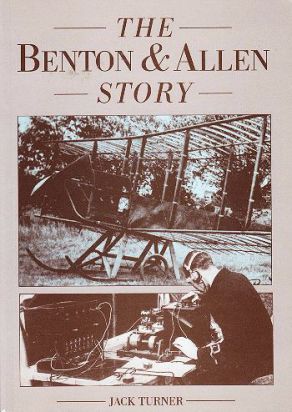
The Benton and Allen Story is a paperback consisting of 162 pages of rare photographs, diagrams, notes and text including letters to and from various government departments that give an insight into what it was like for pioneering aviation designer/manufacturers in the early twentieth century. Published by JGA Turner in 1992 it is now out of print but there may be some good condition second-hand copies to be found on the internet.
Chalvey Airfield location
The airfield was recorded on the Automobile Association list as existing in 1932 but it had certainly been established quite some time before then. The area is now occupied by the Windsor Meadows housing estate. Access would surely have been off Chalvey Grove which was little more than a country road back then.
Chalvey Airfield was located in a 35 acre field known as the Big Pasture that was part of Manor Farm and sited west of Chalvey Grove which was little more than a country lane back then. The field has now been built on forming part of the Windsor Meadows housing estate and has been separated from the farm buildings by the M4 motorway and, more latterly, the Jubilee River.
The location of the airfield in terms of co-ordinates is given as N51°30’28” W0°37’23” or Ordnance Survey grid reference SU956 796. The runway was a grass strip and it had a maximum landing run of 520 yards. The orientation of the runway is likely to have been 05/23. The airfield identity code was X0CY and it was a category A airfield which means it had limited facilities.
The airfield continued to be operated after the First World War by the Jackaman family who lived at the junction of Ledgers Road and Bath Road. The family had a two-seat open cockpits de Havilland Moth and a four-seat enclosed cockpit Monospar. The family would use the Monospar to fly to the coast at Bognor or Norfolk for a swim. On return they would circle the house to ensure that someone would come and pick them up from the airfield. Enid Blyton couldn't have written that one.
It seems the airfield was closed by about 1937 for economic reasons.
My name is Gary Flint. I'm author, photographer & illustrator for Postcards from Slough. If you wish to make any comments on the contents of the website please click on the ladybird below:
Gary Flint
08/03/1961 - 09/04/2019
Postcards from Slough is an independently funded website. We are open to offers of sponsorship from companies that have any connections to the town. To contact us please click on the ladybird below:
Chalvey Community Forum
Postcards from Slough is linked with a local action group the Chalvey Community Forum. The group liaises with various local organisations in order to improve the quality of life for residents in the ward of Chalvey and Salt Hill. To learn more please click on the maidenhair leaf below:
Museum of Berkshire Aviation
I volunteer as a guide at the Museum of Berkshire Aviation. It is a special museum and if you would like to know more about the museum then please click on the motif below:
To learn more about the museums activities while staying within this website click on the tab at the top of the page or on the motif below:
Graces Guide
Postcards from Slough uses some images from Grace's Guide. Click on the button below:
British Listed Buildings
Postcards from Slough contributes material to British Listed Buildings and uses the site for cross referencing purposes. Click on the button below:
