Photographing Puffins on Skomer
Ynys Sgomer
My brother Dennis had an ambition to take close up photographs of puffins so I researched the various sites where they live and where we might get the best views and photos.
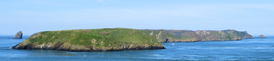
I chose Skomer Island (Ynys Sgomer) which is situated about a mile off the southern point of St Bride’s Bay, Pembrokeshire. The header photo shows Midland Island hiding most of Skomer. Mew Stone is to the south or left of the photo whilst Garland Stone is to the north or right side of the photo.
May 2014 Expedition
I suggested a 24 hour expedition, so Dennis and I set off from Slough at 23:00 on a Friday in May 2014. We followed the M4 most of the way but had to divert to Hungerford and re-join the motorway further on due to road works.
We arrived at Martin’s Haven car park at about 04:00 on Saturday morning. We both managed a little doze until 06:00 and we were greeted by a quite wonderful sunrise and the car park attendant.
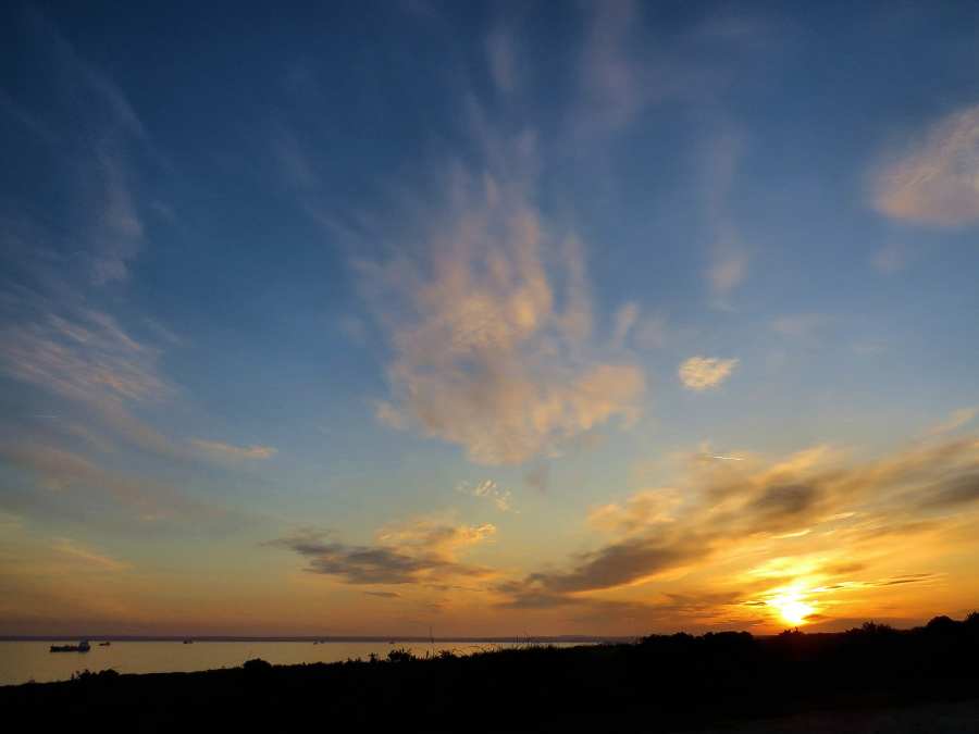
Sunrise at Martin’s Haven
He told us that his boss told him that we weren’t allowed to park overnight. We told him we had only been there a couple of hours and he said ‘I know but it’s the boss’. Apparently the jobsworth boss had seen us arrive but maybe found iit beneath him to deal with us himself We weren’t bothered, everyone’s had a boss like that at some point in our careers.
The attendant did advise us to queue early for tickets for the ferry as some individuals may be buying multiple tickets for a group such as a coachload that might arrive later. On this information we decided to go and wait at the shop. We were first in line at 06:30 and had to wait until 08:00 for the shop to open.
As it turned out it wasn’t a particularly busy day despite perfect weather conditions. Tickets at the time were £11·00 for the ferry and £10·00 landing fee per adult. We would be on the first sailing at 10:00 hours.
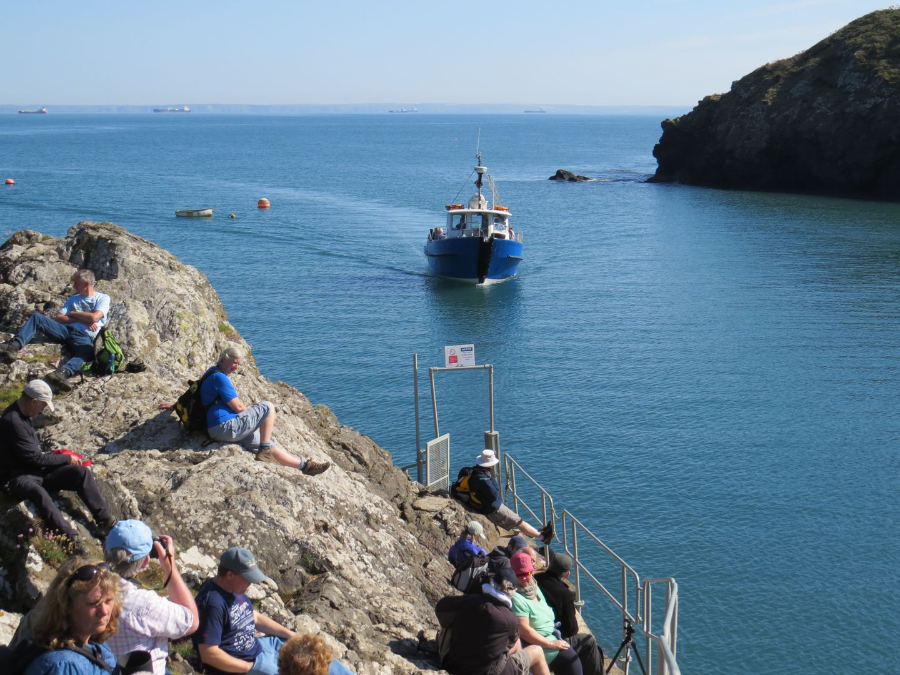
The ferry, Dale Princess, coming into Martin’s Haven.
It was a beautiful sunny day with a clear blue sky to each horizon. The ferry arrived and the passengers from Skomer disembarked with plenty of luggage. They had clearly stayed overnight, perhaps several nights. Once they were clear we embarked which, as I’m not fit, I found to be a bit of a struggle.
The boat was licensed for 50 people but, as we boarded on the starboard side and took our places on the port side facing in, it was difficult to see how everyone else would fit in. It was and once the crewman finished his quick safety lecture with ‘the emergency exits are here and here’ while pointing to the sides and astern of the boat. In other words jump over the sides.
The crossing, which goes around the north of Midland Isle, was on a calm, deep blue sea. When we docked at Skomer I struggled to get out of the bow of the ferry. There was only one bench seat at the meeting area and the first piece of path was an arduous climb for me up to the top of the cliff.
As we left the mouth of the small harbour, we were passing gulls, puffins and other seabirds close to the vessel. We sailed west past the north of Jack Sound. The dorsal fins of a couple of porpoises broke the water. The boat docked in North Haven and we disembarked via the prow which wasn’t easy especially as I wasn’t very fit at the time. We then had to climb the steps an area halfway up the cliff for a short lecture on what to look out for on our visit.
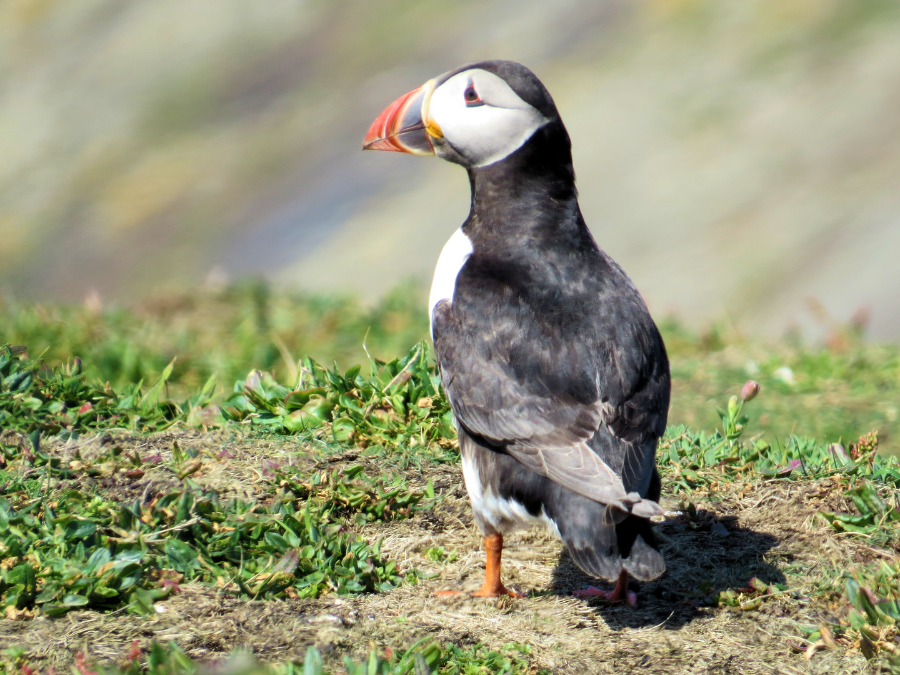
One of my first close encounters with a puffin.
The best was yet to come.
There was only one bench seat at the meeting area and the first piece of path was an arduous climb for me up to the top of the cliff.
There were burrows everywhere, presumably they were Manx shearwater nests as they are nocturnal. At the top of the path, the walk became easier as the island is basically a plateau but with some gentle undulations along the paths.
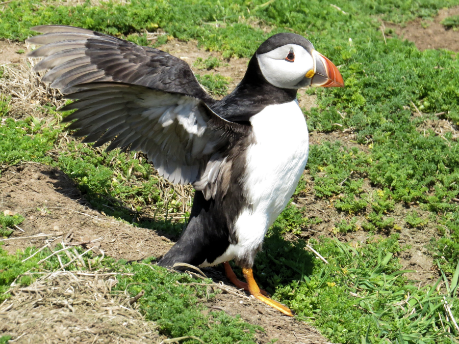
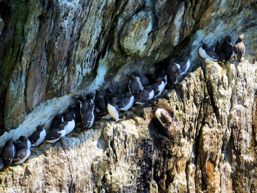
Closer encounter with a puffin at the main colony at the head of a 250m long inlet called The Wick
We followed the coastal path on the south-west side and Dennis decided to go ahead at his own pace. Being Dennis he refused to take the map that I had carefully prepared for him and blundered on. Instead of taking a short cut to where there was a large puffin colony he chose to take the long coastal. Of course I was stupid enough to follow him in case he turned back to look for me.
I should point that at the time I was suffering from high blood pressure and temperature was rising during the mid-morning so I could have done without this.
They are so cute!
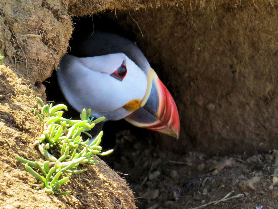
At the head of the Wick was a small group of people had gathered because this is where close encounters with puffins was at its best. Puffins are normally very shy and cautious of humans. Here, they would walk between your legs to get to their burrows. It was an extraordinary and truly unforgettable experience.
Other birds here included chough flying in their characteristic playful way while fulmars wheeled around on stiff-wings. A warden had a telescope set up for people to view the puffins and other seabirds on the south cliff.
Dennis and I rested on a bench a little way along the path to have some food. I told him that I wouldn’t be doing the whole island. I gave Dennis the map so that he could carry on and on this occasion he accepted it. We agreed to meet at The Farm in the centre of the isle.
I went back to the puffins for a little while then struck out along the path to the east for another path to the north to The Farm. I had some more food and rested until Dennis turned up.

The Farm
I needed to use the toilet so I left Dennis in charge of my back pack. When I came out he had this hilarious idea to take my pack to the top of the hill for me to retrieve. He seems to think he’s helping me to get fit and his way is the only way. I have told him repeatedly that I have been diagnosed with high blood pressure and that unnecessary physical exertions could kill me. He needs to have the cotton wool surgically removed from his ears.
I struggled to retrieve my back pack. What I should have done as to tell him bring my pack down or I would go home without him. He would then have to find his own way to go the 250 miles to get home. It was mid-afternoon and hot and there’s my blood pressure to consider and this wasn’t the time for an argument.
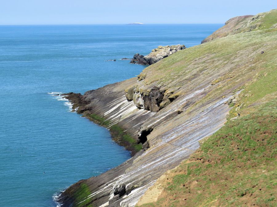
We set off for the ferry on a path to the east. The north-east side of the island was covered with huge areas of bluebells tinged with the pink of campion.
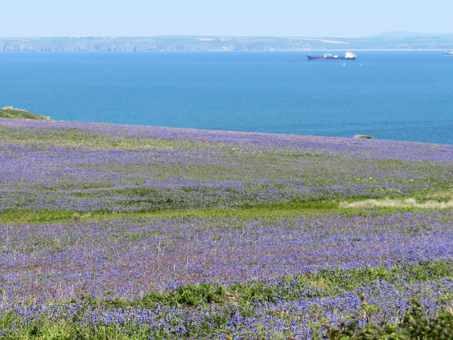
The view to the north-east of the island
When we finished we followed the path to the east back to the boat. A nice bonus for us was that while we waited in the queue a razorbill was on a ledge waiting patiently all day for us to come along and take its photo.
Other wildlife seen on the island apart from various gulls were a couple of whitethroat near The Farm, several dunnock, oystercatchers, rabbits and a skylark.
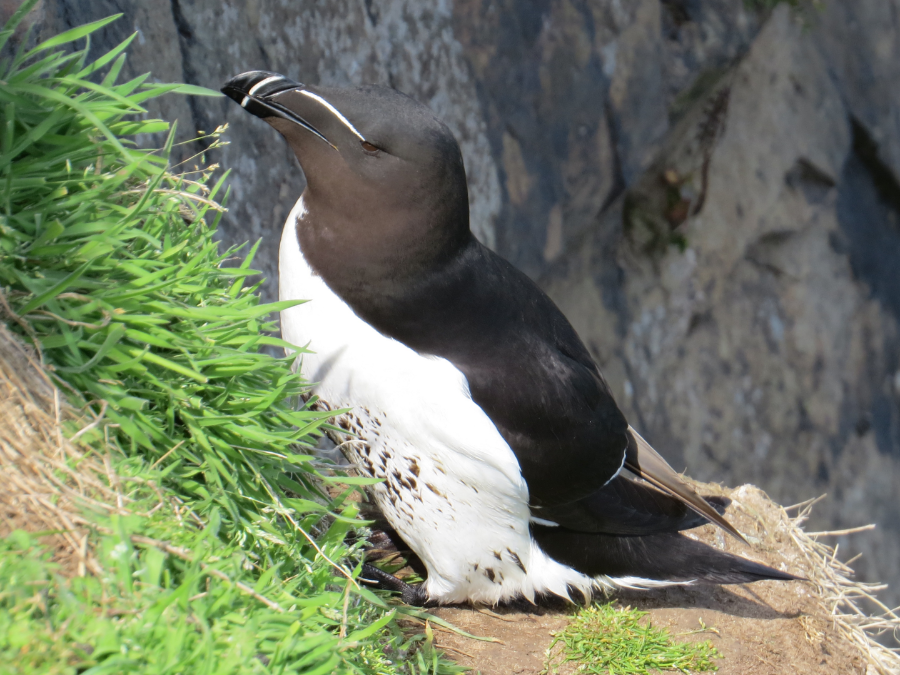
A seemingly proud and aloof Razorbill
It wasn’t long before the ferry Dale Princess arrived to take us back to the mainland. We embarked at 15:00 and the cruise back to Martin’s Haven was uneventful.
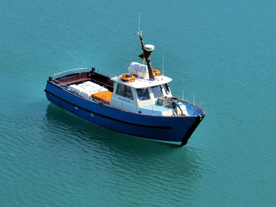
The Dale Princess
We got back to the car and packed our things. Dennis, with no regard for me or what I wanted to do, wasted no time to phone his wife to tell her that we would be leaving immediately and that to expect him back for 20:00. I needed a rest but again I said nothing and we set off. I was shattered.
We stopped for fuel at Haverfordwest and at some point beyond there but before the M4 I handed the driving over to Dennis through being over tired. We got to my house at about 19:20. I was shattered and resolved that apart from planning the journey times and driving him on his 3 Peaks challenge due next month, this would be the last expedition that I would ever do with him.
Skomer Statistics
The majority of Skomer is 200ft (60m) above sea level while the highest point is 259ft (79m). The island is administered by The Wildlife Trust of South & West Wales.
Length: 2 miles (3·2km); Width: 1·4 miles (2·4km) Area: 1·13 square miles (2·9 square km).
Coordinates: 51°44′10″N 5°17′47″W
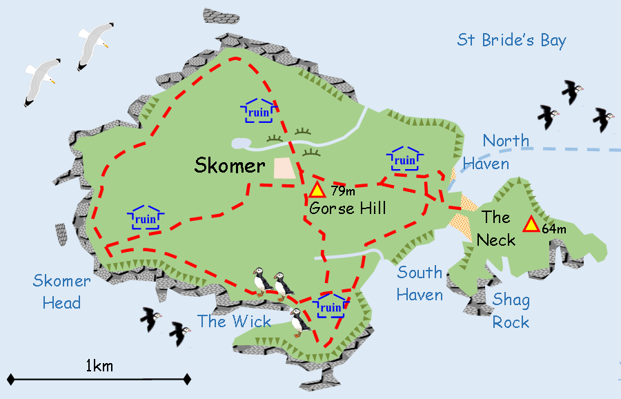
Skomer Island. The map that Dennis refused to use at first
Selected places to see seabirds
There are various sites around the UK to view Puffins and other seabirds. Here is a selection of places that I have either direct or third party knowledge of the access to them.
Skomer Island summary National Trust
West Pembrokeshire coast
Lat/Long: 51°44’16”N 5°17’47”W
OS grid: SM 725 095
A superb place to see puffins as they are so used to humans that they come very close. There are some issues with access though. Firstly, there is no advanced booking so get to the shop to buy your tickets by at least 06:00 and queue straight away. A man waiting alone might be a coach driver and might be buying 50 tickets for his passengers. That is a whole ferry load and there are only three ferries a day.
Embarking and disembarking the ferry is via the prow and this is very difficult unless you are fully fit. On the island the path begins with a very steep climb of about 200ft to the top of the cliff. The return trip is five hours later. Check the website for details.
http://www.pembrokeshire-islands.co.uk/boat-trips/land-on-skomer/
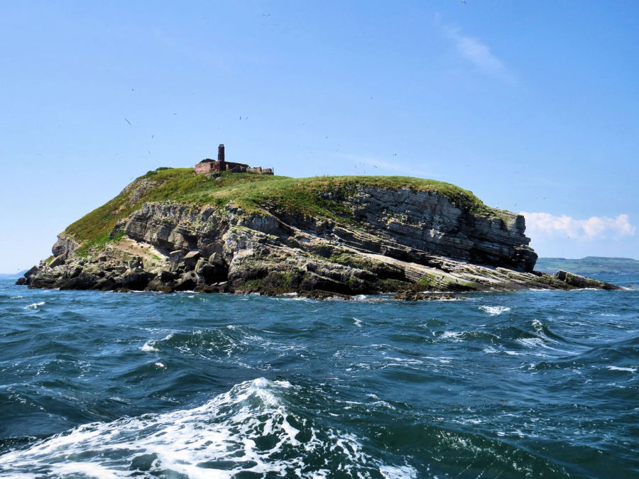
The north side of The Wick, a 250m long inlet on the south-west of the island. The island in the distance is Grassholm and the white patch on the right side is a gannet colony of some 36,000 breeding pairs. There are boat trips to the island but no landing.
South Stack
Ynys Lawd
RSPB, Anglesey, North Wales
Lat/Long: 53°18’24”N 4°41’38”W
OS grid: SH 206 822
South Stack is a rocky headland with cliffs that rise to about 250ft. To get to the optimum viewing point you need to go down the winding steps that lead to the lighthouse to the last bend. There are eight. It is very steep and of course there is the return journey to consider, a hard climb of at least 150ft.
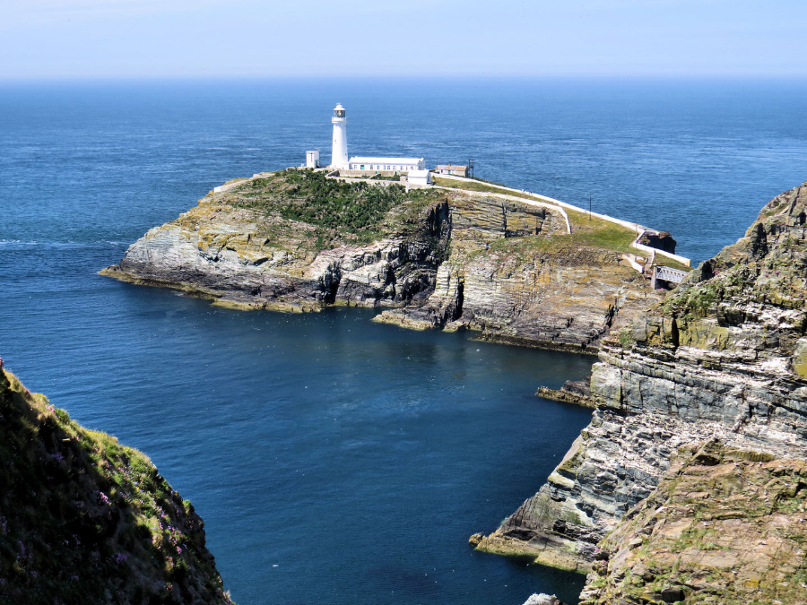
Lighthouse at South Stack
From here there may be good views of ledges of guillemot nests on the cliff at the same level. However if numbers are down these ledges may be abandoned for ones lower down. Puffins and razorbills are much lower down at the base of the cliff and are far enough away to be hard to identify with the naked eye.
Other birds that may fly close by are fulmar, chough and peregrine falcon.
Guillemots at South Stack
Puffin Island
Ynys Seiriol
Anglesey, North Wales
Lat,Long: 53°19’00”N 4°01’01”
OS Grid: SH 649 821
Puffin Island is a small uninhabited island off the eastern point off Anglesey. It is a Special Protection Area for wildlife so there is no public access. In the spring and summer Puffin Island Cruises offer 90 minute trips to the island from Beaumaris.
Puffin Island has a large cormorant colony numbering over 750 pairs. It also has good numbers of guillemot, razorbill, puffin, shag and kittiwake. In recent years small numbers of black guillemot and common eider have begun to nest there.
The abundance of fish in the surrounding waters supplies food for a colony of grey seal. Bottlenose dolphins and harbour porpoises regularly visit the area.
Bempton Cliffs
RSPB, Near Bridlington, East Riding of Yorkshire
Lat/Long 54°08’48”N 0°10’07”W
OS Grid TA 197 738
Park in the RSPB car park and take the path down to the cliffs and follow the path to the left. The cliffs are about 100ft tall at this point and rise gently to 400ft.
Over 250,000 seabirds nest here each year including gannets, guillemots, razorbills, puffins, kittiwakes and fulmars. Puffins are there between mid-April and mid-July. Thousands of gannets stay from February to October. The cliffs are home to the largest kittiwake colony in mainland Britain.
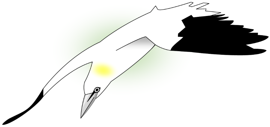
Impression of a gannet from a photo taken at Bempton Cliffs in 2003
The main attraction here is the atmosphere of the huge cliffs combined with the sight of so many seabirds patrolling the cliffs. Because of the north-east aspect of the cliffs, a good plan might be to visit them in the morning while the sun is shining on them, then go down into nearby Bridlington in the afternoon and take a boat trip on the Yorkshire Belle along the cliffs in the afternoon in the hope of seeing gannets diving into the sea.
Other seabird colonies around England and Wales include the Farne Islands, Lundy and St Bees Head.
Farne Islands
Graham Parker photography
Inner Farne and Staple Island
Lat/Long: 55°37’17”N 1°37’42”W
OS grid: NU 235 365
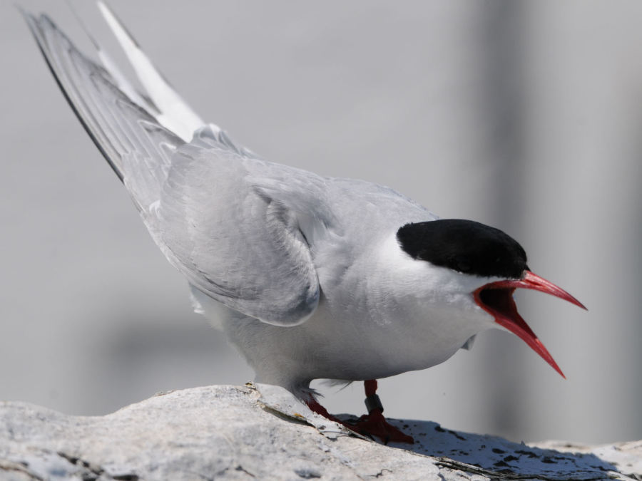
The Farne Islands consist of some twenty islands in the far north-east of England. It includes Inner Farne and Staple Island both of which have seabird colonies on them. Staple Island has a boardwalk. On one of the islands the path runs through a tern colony and the terns will buzz and attack visitors in defence of their nests, sometimes even drawing blood.
Arctic tern Sterna paradisaea
 © 2016 Graham Parker
Arctic terns are quite distinct from gulls as they are slimmer and more graceful in appearance and flight. They have long tail streamers long pointed wings and their aerobatic flight they are sometimes nicknamed ‘sea swallows’.
Arctic terns have light grey topsides, white undersides, a black cap and a red bill. Their legs are short and orange. They are mostly coastal some come inland during migration. Arctic terns are the ultimate long distance migrants spending summer to breed in the UK then visiting the Antarctic in our winter.
The UK breeding pairs are estimated at 53,000 pairs. Arctic terns eat mainly fish but will also eat crustaceans and insects.
Length: 33-35cm; Wingspan: 75-85cm; Weight: 95-120g
Kittiwake Rissa tridactyla
 © 2016 Graham Parker
Kittiwakes are medium-sized gulls with a small yellow bill. They have a light grey back with white undersides. Their legs are short and black. In flight the black wing-tips show no white, unlike other gulls. The population is declining in some areas, perhaps due to a shortage of sand eels. After breeding, birds move out into the Atlantic where they spend the winter
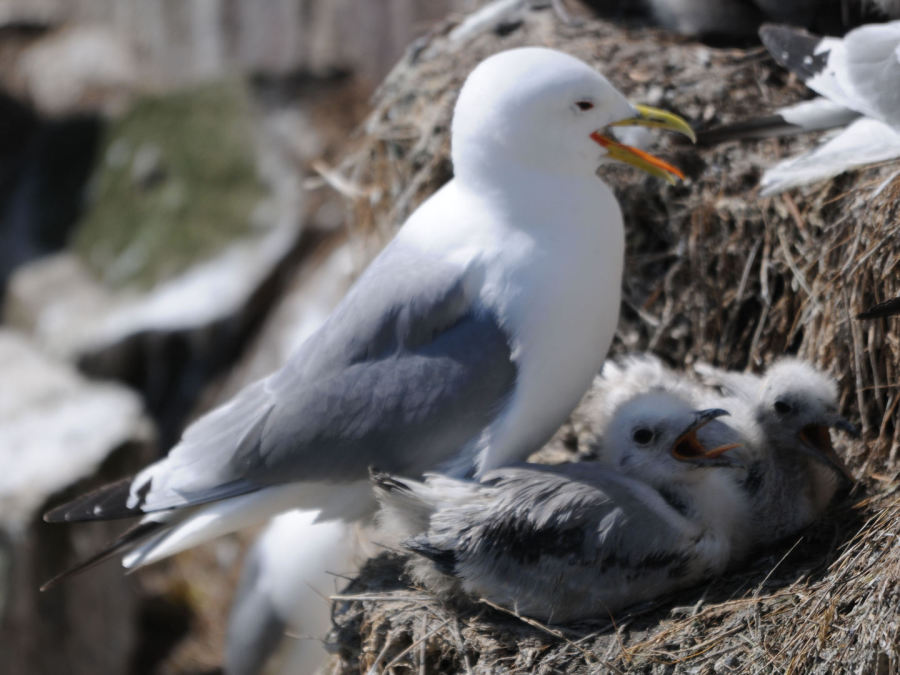 © 2016 Graham Parker
The UK breeding pairs are estimated at 380,000 pairs. Kittiwakes feed on Fish, shrimps and worms.
Length: 38-40cm; Wingspan: 95-110cm; Weight: 300-500g
Shag Phalacrocorax aristotelis
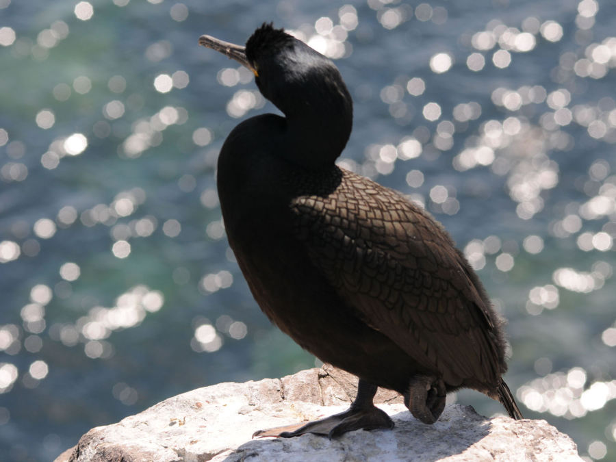 © 2016 Graham Parker
Shags are similar to cormorants but smaller and slimmer. In the breeding season adults develop a dark glossy green plumage and prominent recurved crest on the front of their head. In the UK they breed on coastal sites, mainly in the north and west, and more than half of their population is found at fewer than 10 sites, making them a Red List species. Shags usually stay within 100-200km of their breeding grounds.
UK breeding pairs are estimated at 27,000 pairs. An estimated 110,000 birds winter here. Sags feed on fish and occasionally crustaceans and molluscs.
Length: 65-80cm; Wingspan: 90-105cm; Weight: 1·75-2·25kg
 © 2016 Graham Parker
A shag tending its young
Guillemot Uria aalge
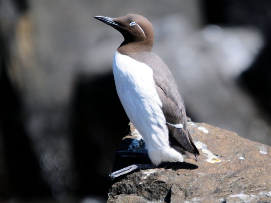 © 2016 Graham Parker
The guillemot is one of the most numerous seabirds in sea bird colonies. Like other auks it comes to land only to nest, spending the rest of its life at sea. its plumage is dark brown and white, not as black as the similar razorbill. It has a 'bridled' form with a white ring round the eye and stripe behind it.
UK breeding pairs are estimated at 950,000 pairs. Guillemots feed on Fish and crustaceans.
Length: 38-45cm; Wingspan: 64-73cm; Weight: 850-1,130g
Puffin Fratercula arctica
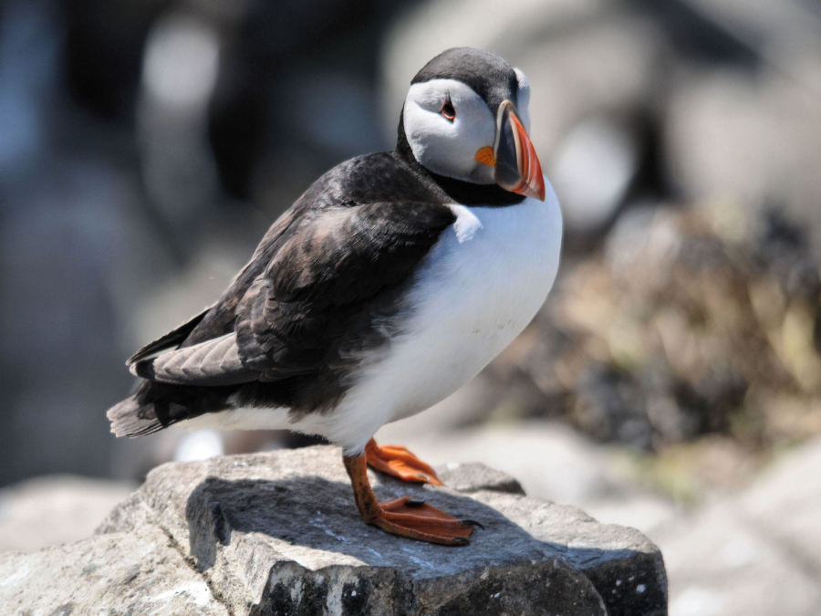 © 2016 Graham Parker
In the summer puffins are unmistakable birds with their large colourful bills and their black topsides, white underparts an orange legs with webbed feet. The colourful bills are made of plates that are only there during the breeding season. In te winter they fall off and the bird looks rather drab.
UK breeding pairs are estimated at 580,000 pairs. Puffins feed on fish, especially sand eels.
Length: 26-29cm; Wingspan: 47-63cm; Weight: 320-480g
 © 2016 Graham Parker
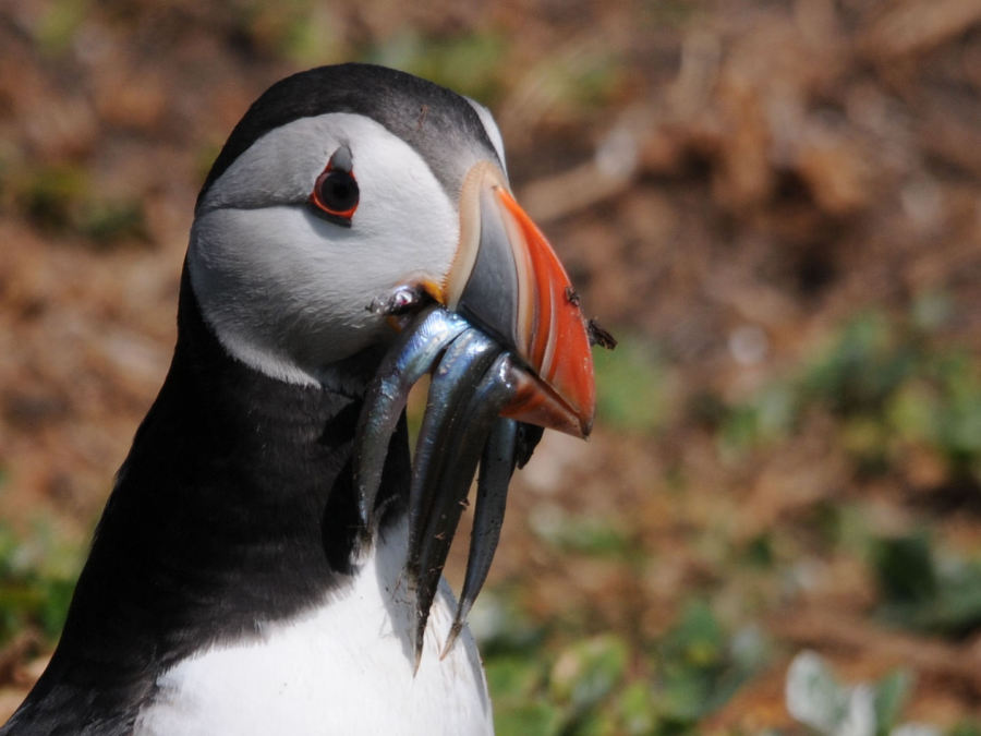
A Puffin demonstrating its ability to carry more than one sand eel at a time
My name is Gary Flint. I'm author, photographer & illustrator for Postcards from Slough. If you wish to make any comments on the contents of the website please click on the ladybird below:
Gary Flint
08/03/1961 - 09/04/2019

Postcards from Slough is an independently funded website. We are open to offers of sponsorship from companies that have any connections to the town. To contact us please click on the ladybird below:

Chalvey Community Forum
Postcards from Slough is linked with a local action group the Chalvey Community Forum. The group liaises with various local organisations in order to improve the quality of life for residents in the ward of Chalvey and Salt Hill. To learn more please click on the maidenhair leaf below:

Museum of Berkshire Aviation
I volunteer as a guide at the Museum of Berkshire Aviation. It is a special museum and if you would like to know more about the museum then please click on the motif below:

To learn more about the museums activities while staying within this website click on the tab at the top of the page or on the motif below:

Graces Guide
Postcards from Slough uses some images from Grace's Guide. Click on the button below:
British Listed Buildings
Postcards from Slough contributes material to British Listed Buildings and uses the site for cross referencing purposes. Click on the button below: